China Daily | Updated: 2022-02-14
Chinese geologists have revealed how and when the Central Tibetan Valley rose from a low valley to its current soaring height, providing new clues to the formation of "the roof of the world".
In a study published on Thursday in the journal Science Advances, they showed that the Central Tibetan Valley was at a relatively low elevation of 1,700 meters between 50 million and 38 million years ago, sustaining a diverse subtropical ecosystem.
It rose rapidly to become part of what is now the Qinghai-Tibet Plateau, which sits at an elevation of over 4,000 meters, between 38 million and 29 million years ago, according to the study.
Chinese and British scientists, led by Ding Lin from the Chinese Academy of Sciences' Institute of Tibetan Plateau Research, collected a large number of samples from the Lunpola Basin in the center of the valley for radiometric dating and clumped isotope analysis.
They found nine layers of volcanic tuffs there and established the absolute age of ancient sediments in the basin, thus revealing the exact point of geological transition.
The study showed that with increased elevation and the cooling of the global climate, the temperature and precipitation in the central plateau decreased significantly, with the warm-humid, low-elevation subtropical ecosystem that served as an incubator for today's Asian biodiversity giving way to a high, cold-dry alpine ecosystem.
Ding's team proposed a new model for the formation of the Qinghai-Tibet Plateau, in which the Lhasa mantle fell away and/or was thermally eroded, allowing the upwelling of the asthenosphere, a thin semifluid layer of the earth.
That process softened the crust above and facilitated the northward movement of India, finally giving rise to multiple high mountains, including the Himalayas, according to the study.
(Source: China Daily)
Xiong, Z.Y, Liu, X.H, Ding, L.*, Farnsworth A., Spicer, A., Xu, Q., Valdes P., He, S., Zeng, D., Wang, C., Li, Z., Guo, X., Su T., Zhao, C., Wang H., Yue Y. The rise and demise of the Paleogene Central Tibetan Valley. Science Advances, 8, eabj0944 (2022).
https://science.org/doi/10.1126/sciadv.abj0944
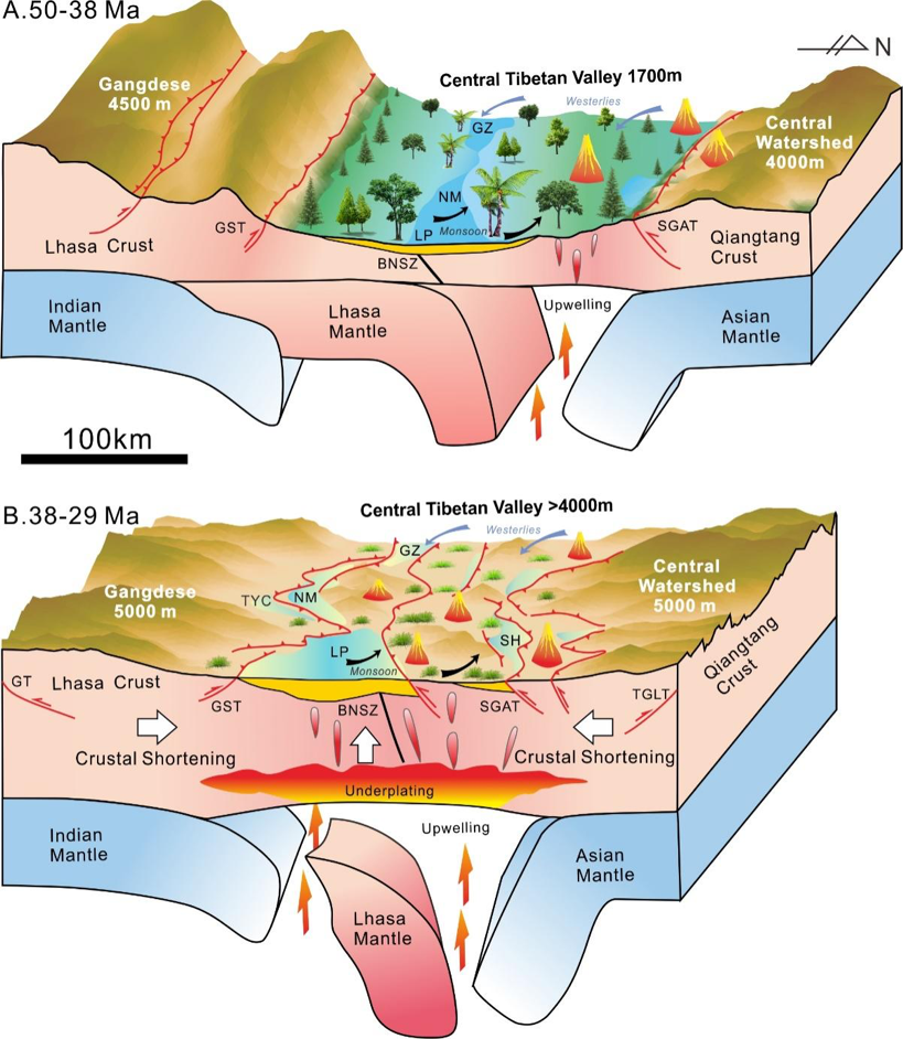
图1. 青藏高原中央谷地3800-2900万年前隆升和消亡过程。
A. 5000-3800万年前:青藏高原呈现为“两山夹一盆”的地貌特征,即高海拔的冈底斯山脉和中央分水岭山脉之间夹着低海拔的中央谷地。中央谷地气候温暖湿润,降水由西风和季风共同主导,亚热带动植物繁盛,是高原内部的“香格里拉”。
B. 3800-2900万年前:中央谷地快速隆升为大于4000 m的高原,地表温度下降,降水减少,且降水主要受季风控制,高山草甸为主要地表植被。
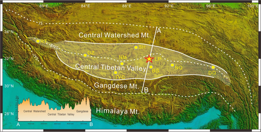
图2. 青藏高原中央谷地范围(白色阴影区)及地表高度变化剖面,五角星代表研究地点伦坡拉盆地位置
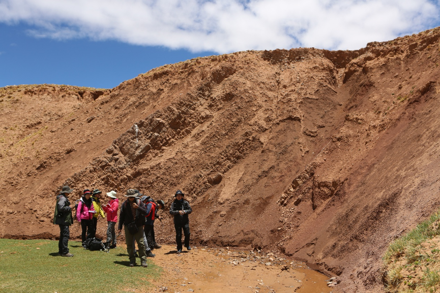
图3. 丁林院士带领团队在伦坡拉盆地进行野外考察
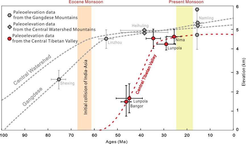
图4. 青藏高原中央谷地、冈底斯山脉、中央分水岭山脉和喜马拉雅山脉古高度历史重建图

图5. 碳酸盐团簇同位素分析系统
http://www.itpcas.ac.cn/new_kycg/new_kyjz/202202/t20220210_6353527.html